
During the period from August 2 to August 5, 2022, Dr. Hsuan-Chang Shih, the co-host of the Taiwan-India Overseas Research Center, received a grant from the National Science and Technology Council (NSTC) to go to Bandung, Indonesia to participate in the 16th South East Asia Survey Congress (SEASC) and the Indonesian Institute of Surveyors Annual Scientific Forum "Connecting Towards Sustainable Development".
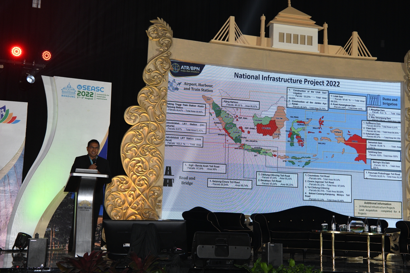
This Conference is a regular meeting of the Association of Southeast Asian Nations (ASEAN). The conference and exhibition is organized by the collaboration of Indonesian Surveyor Association (ISI), Federation of LAND Surveying and Geomatics (AFLAG), FTSP – Institut Teknologi Nasional – Bandung and is supported by Ministry of Agrarian Affairs and Spatial Planning/National Land Agency (ATR/BPN), Ministry of PUPR, Dishidros TNI-AL & Geospatial Information Agency (BIG). The event will bring together National and International Academics, The Ministry and The National Institute, Local Government, Researcher, Surveying Industry Association, Surveyors, students and Observers from ASEAN Countries, Australia & Taiwan to share insights into the challenges, opportunities and connectivity for sustainable improvement of Surveying, Geodesy, Geomatics, Hydrography and its application in solving or help the problems of Sustainable Development Growths (SDG’s) in Indonesia especially and South East Asia countries. Therefore, by participating in this meeting, TIUL can fully understand the policy direction and needs of Indonesia and ASEAN in the field of surveying and mapping, which is a good opportunity for Taiwan to actively participate in ASEAN.
At the opening ceremony of the conference, Governor of West Java H.M. Ridwan Kamil, S.T., M.U.D. and Gerry Ong, current Chairman of ASEAN FLAG, gave an overview of the series of events including the conference itself, showcases, paper sessions and a talk forum about the industry. The conference also presented the past researches from Southeast Asia, Australia and Taiwan, focusing on topics such as equity and risk, learning, capacity building, methodologies and possible investment methods in surveying, geodesy, geoinformatics and hydrology. Dr. Hsuan-Chang Shih, also represented TIUL to delivered a research paper (oral speech) on the second day of the conference, sharing academic research on the use of multi-beam echo sounders for unmanned ground vehicles to measure the water depth of agricultural irrigation ponds and experience.
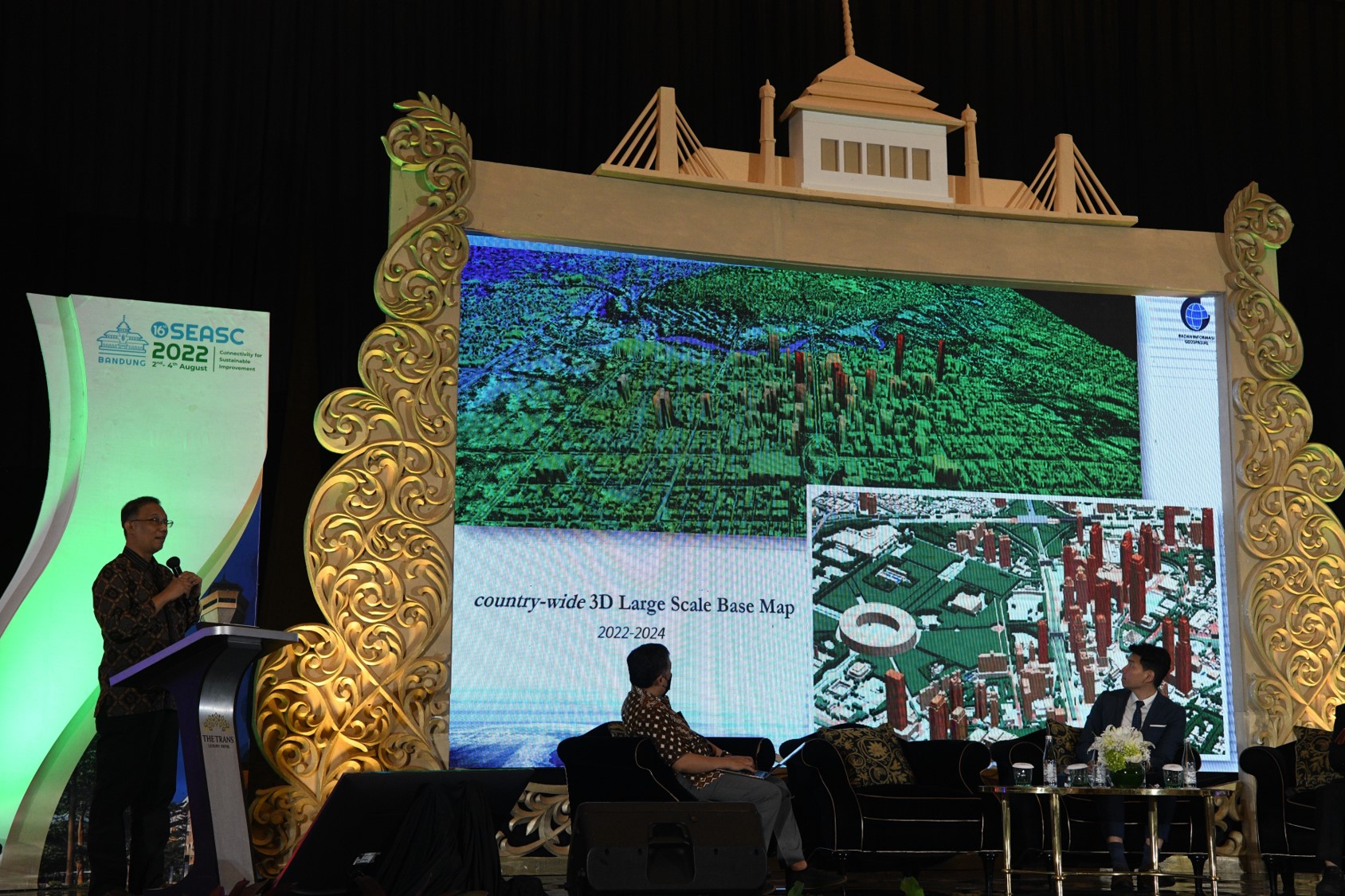
In addition to the 16th SEASC Forum, it also commemorates the 50th anniversary of the Ikatan Surveyor Indonesia Annual Science Forum (FIT-ISI). Dr. Hsuan-Chang Shih also represented TIUL to participated in the Surveying and Mapping Technology Expo jointly organized by SEASC and ISI. Understand the development and current status of surveying and mapping technology of Indonesian manufacturers, and that drones and unmanned ships are being widely used in Indonesia's land surveying and mapping work, assisting manufacturers in quickly collecting and updating data. This Expo also attracts many different surveyor companies, enabling them to share and exchange the latest information and technological progress in the field of surveying with experts, scholars and researchers from all over the world.